
Leading online GIS platform for professional mapping applications & spatial data
Yourinfrastructuremapped
Your
infrastructure
mapped
From data to insight. From map to action. With spatial intelligence, you convert geographic data into strategic decisions - from urban planning to environmental monitoring. GeoApps helps organizations decide faster, smarter, and more visually for greater impact in a complex world.
Ready to start your first project?
Join 300+ organizations already using GeoApps for their spatial challenges.


Viewer
Interactive map viewer for spatial data
More information
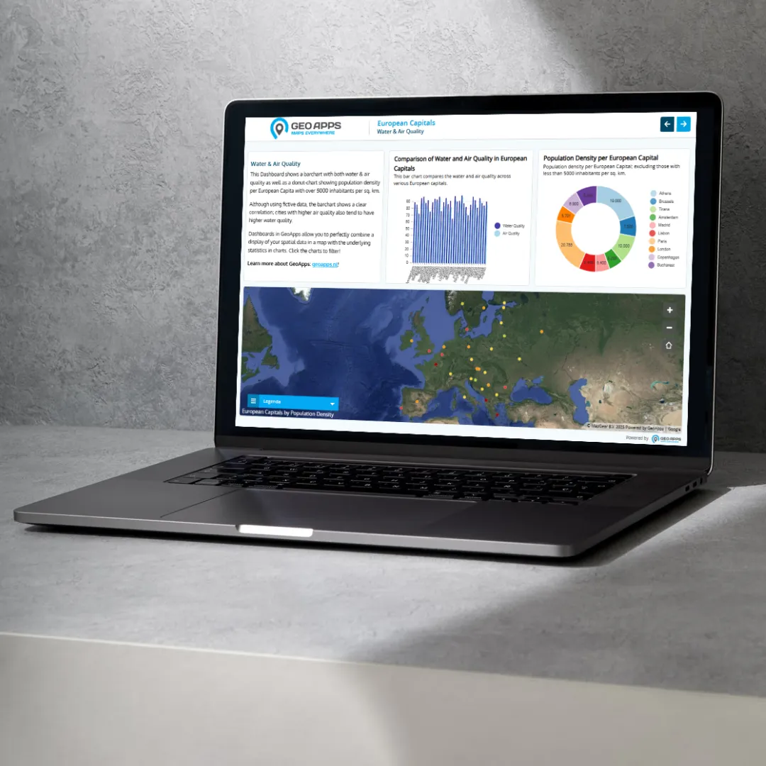
Dashboard
Data visualization and analytics dashboard
More information
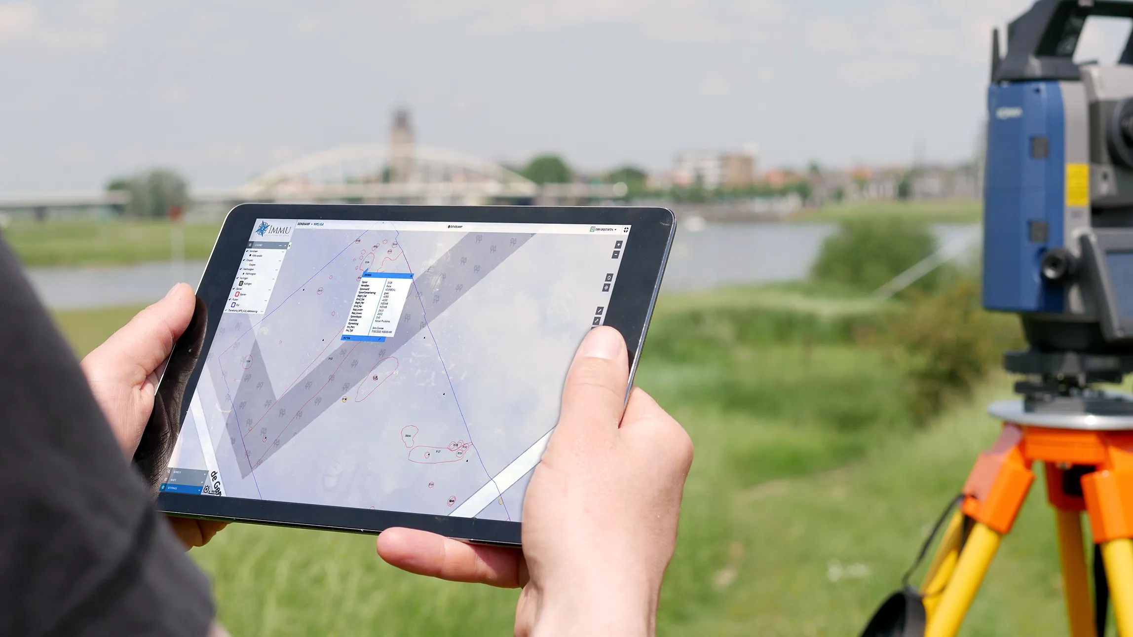
Fieldwork
Mobile app for field data collection
More information
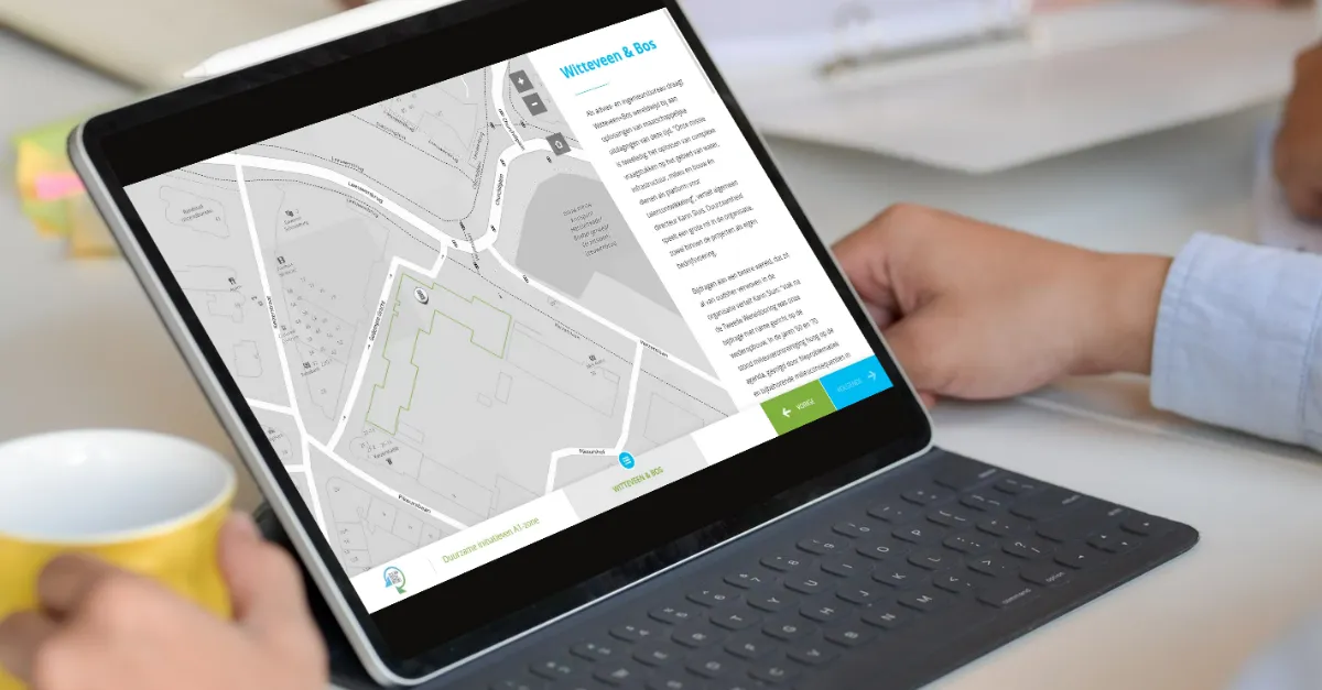
MapTour
Interactive map tours and storytelling
More information
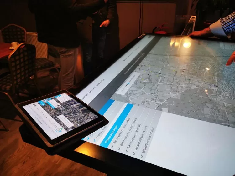
MapTalk
Public participation platform
More information

Custom Apps
Custom GIS solutions for your needs
More information
home.apps.samenwerkapp.title
home.apps.samenwerkapp.description
More information
home.apps.takenkaart.title
home.apps.takenkaart.description
More information