GeoApps Logo
Apps
Solutions
Platform
About us
Get adviceLogin
  1. Home
  2. Apps
  3. Custom
Custom icon
Custom

Build your own app with GeoApps

Do you want a map application that precisely fits your work processes – and does standard functionality not offer exactly what you need? With the GeoApps development platform, you can easily build your own application on top of a powerful and proven foundation. Use available building blocks and smart map components to quickly develop a complete solution that remains affordable and manageable.

Get a Demo
Custom GIS Applications Development

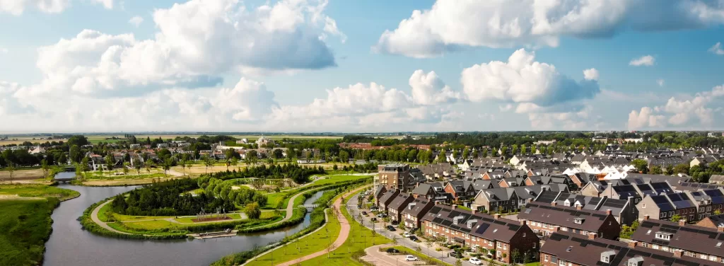
Please accept cookies to play this video

Chosen by organizations that wanted more

From consultancy to engineering firms: more and more organizations are building their own map application based on GeoApps. This is how they create a solution that truly fits their processes, users, and goals.

  • Gemeente Rotterdam
  • Arcadis
  • Stantec
  • Enexis
  • ProRail
  • Tauw
  • Natuurmonumenten
  • Provincie Overijssel
  • Regio Foodvalley
  • Mapification
  • Arup
  • Kragten
  • Waternet
  • FactoGeo
  • Keypoint
  • Gemeente Enschede
  • Qwello
  • Procap
  • Rabobank
  • Aventus
  • Ecogroen
  • Woonbedrijf
  • Q-Estate
  • Transitiemakers
  • Deloitte
  • Gemeente Haarlemmermeer
  • Regio Stedendriehoek
  • Collectie Overijssel
  • Duurzaamheidskaart
  • Omgevingswarmtekaart
  • Assetmaps
  • Gemeente Utrecht
  • Gemeente Hengelo
  • Gemeente Apeldoorn
  • Gemeente Maastricht
  • Gemeente Ede
  • Gemeente Epe
  • Gemeente Gennep
  • Gemeente Maasgouw
  • Gemeente Wierden
  • Gemeente Zundert
  • Gemeente Deventer
  • Gemeente Dordrecht
  • Gemeente Rijswijk
  • Gemeente Leiden
  • Gemeente Sittard-Geleen
  • Westerkwartier
  • Gemeente Groningen
  • Gemeente Voorst
  • Provincie Utrecht
  • Provincie Gelderland
  • Provincie Noord-Holland
  • Provincie Flevoland
  • Provincie Groningen
  • Provincie Drenthe
  • Dekker Groep
  • Van Dun Advies
  • Roelofs
  • Roelofs Lemelerveld
  • Nouryon
  • Syntraal
  • Stedin
  • CCS Energie-advies
  • PraatMee
  • MapServices
  • Satellic
  • Wegenscanners
  • Zone College
  • Stadscampus De Kien
  • Saxion
  • Natuur en Milieufederaties
  • Omgevingsdienst Brabant-Noord
  • RVO
  • Omroep Brabant
  • Thius
  • Tijdlab
  • Mateboer
  • Aveco de Bondt
  • Riese & Geurts
  • OMWB
  • TTE
  • KWR
  • Lycens
  • Nordend
  • Royal HaskoningDHV
  • MapGear

What do you need for your own map app?

Whether you want to get started right away or prefer to develop it yourself: GeoApps offers flexibility and ease of use. Choose the approach that suits your organization and start today.

Standard apps

Use our existing apps, such as Viewer, MapTour, and Dashboard. With the visual editor (WYSIWYG), you can easily put them together - without programming.

View available apps

Low-code development

Quickly create your own apps with the smart building blocks in the GeoApps UI framework. Use ready-made components and code examples from our developers.

GeoApps Developer Portal

Full-code: custom work without limits

Use our powerful APIs to integrate GeoApps functionality into your own application or build a completely new solution.

Schedule a meeting

Custom solutions in practice

Discover how organizations use GeoApps to build their own GIS applications – from heritage to energy transition – with real impact as a result.

Collection Overijssel

Digitization of cultural heritage

Two accessible applications bring the past to life: a digital field name map for all of Overijssel and an educational WW2 map, especially for students and researchers.

2 apps developed
500+ users

Stantec

GIM platform for area information management

Stantec built a Area Information Management (GIM) portal with a smart Soil Advisor. This platform supports efficient soil advice and provides real-time insight into environmental data for infrastructure.

1 portal built
1000+ users

Deloitte

Rooftop Solar Tool

This application shows real estate parties at a glance which roofs are suitable for solar panels – including technical and financial substantiation.

1 tool developed
200+ users

Why customers choose custom solutions with GeoApps

More and more organizations are building their own GIS solution on the GeoApps platform. Read how custom applications help them streamline processes, improve insights, and make a real difference.

Deloitte

Deloitte

"With the Rooftop Solar Tool, we give property owners and developers direct insight into the solar potential of their roofs; the first reactions are enthusiastic and colleagues are already thinking about new expansions."

Omaima Ez-Zaitouni, Senior Consultant

Custom Development

From simple tools to complete GIS solutions - fully tailored to your processes and information needs.

Custom Development

From simple tools to complete GIS solutions - fully tailored to your processes and information needs.

Seamless data integration

Easily connect with existing data sources and systems – so that all information comes together in one clear environment.

Extensive framework

Use existing building blocks and components. Connect to other systems via REST APIs and web services.

Security at the highest level

Full control over user rights, logging, and privacy – including support for ISO standards and GDPR requirements.

Ready for your custom solution?

Tell us your wishes and discover how you - yourself or together with our developers - can realize an application that perfectly matches your processes and goals.

Contact Us
GeoApps Viewer
Gasfabriek project
MapGear team office

Custom Development FAQ

Frequently asked questions about custom GeoApps development and tailored GIS solutions.

What types of custom applications can be built?
GeoApps supports building any type of spatial application including specialized dashboards, data collection tools, analysis platforms, integration solutions, and complete GIS systems tailored to your specific workflow requirements.
Do I need programming experience?
No programming experience is required for basic customizations. Our visual editor allows you to build applications using drag-and-drop components. For complex requirements, our development team provides support and can handle the technical implementation.
How long does custom development take?
Development time varies based on complexity. Simple applications can be built in days using our low-code tools. Complex enterprise solutions typically take 4-12 weeks, depending on requirements, data integration needs, and testing requirements.
Can custom apps integrate with existing systems?
Yes, GeoApps excels at integration. We support REST APIs, web services, database connections, and standard protocols like WMS/WFS. Custom integrations can be built for proprietary systems or unique requirements.
What level of customization is possible?
Full customization is possible including branding, user interface design, workflow logic, data processing, security policies, and integration requirements. Applications can be built to match your exact specifications and processes.
How much does custom development cost?
Costs vary based on complexity and scope. Simple applications start at €5,000-€15,000. Complex enterprise solutions range from €25,000-€100,000+. We provide detailed proposals based on your specific requirements.
GeoApps Logo

GeoApps is the leading software platform for GIS applications and spatial data, enabling organizations to make data-driven decisions.

Solutions

  • Urban Planning
  • Infrastructure
  • Real Estate
  • Environment & Climate
  • Energy Transition
  • Safety & Risk

Products

  • GeoApps
  • Solutions
  • Sustainability Map
  • MapServices
  • TouchTable
  • Consultation

Apps

  • Viewer
  • Dashboard
  • Fieldwork
  • MapTour
  • MapTalk
  • Custom

For whom?

  • Municipalities
  • Provinces
  • Environmental Services
  • Engineering
  • Contractors
  • Safety Regions

Platform

  • Integrations
  • Documentation
  • System Status
  • Changelog
  • Support
  • Subscriptions

Company

  • About Us
  • Careers
  • Contact
  • Partners
  • News & Blog
  • Events

Stay up-to-date

Subscribe to our newsletter to get the latest updates on our products and services. You can unsubscribe at any time.

Keep an eye on our socials too

Stay connected with us through our social media channels and get the latest updates on our products and services.

Quality & trust

MapGear is ISO 9001 and ISO 27001 certified and meets the highest quality and security standards for our products and services.

ISO 9001 Certificering
ISO 27001 Certificering
QGIS Membership 2026

© 2026 GeoApps, a product of MapGear B.V.

Privacy PolicyTerms of Service