Digital Citizen Participation Platform
Engage citizens in spatial planning with interactive maps, surveys, and discussions.
Get a DemoTrusted by Participation Professionals
From municipalities to NGOs, our participation platform helps organizations effectively engage communities.


Powerful Features for Citizen Participation
Everything you need for successful community engagement and citizen participation.
Citizen Engagement
Engage citizens in meaningful dialogue about community issues.
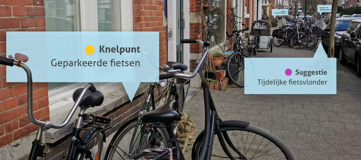
Location-based Input
Collect geographically specific feedback and suggestions.
Interactive Discussions
Foster community discussions with moderation tools.
Real-time Analytics
Track participation and analyze community sentiment.
Data Management
Organize and manage all citizen input efficiently.
Privacy & Security
Ensure secure and private citizen participation.
Multi-channel Sharing
Share consultations across multiple platforms.
Comprehensive Reports
Generate detailed reports on participation and outcomes.
How It Works
Start citizen participation in four simple steps.
Create Project
Set up your participation project with custom questions and areas.
Invite Citizens
Share your project and invite community members to participate.
Collect Feedback
Citizens provide input through maps, surveys, and discussions.
Analyze Results
View insights and make informed decisions based on community input.
Why MapTalk?
The main reasons organisations choose MapTalk.
Reach more residents
Engage a broader and more diverse group than with physical meetings alone – including people who wouldn't participate otherwise.
Build trust
Transparent participation shows what matters to people and strengthens support for your plans.
Save time
Input comes in structured, linked to location – ready for analysis and better decision-making.
Make impact measurable
From neighbourhood to region: scale participation and demonstrate the value of citizen engagement.
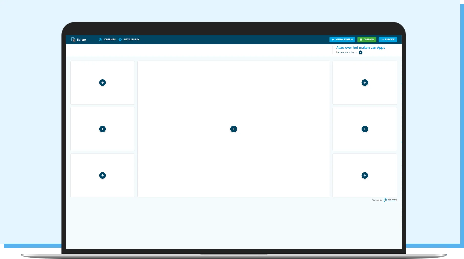
Create project
Easily create a new MapTalk project, including map, questions, topics, and target groups.
Simple project management with intuitive interface
Map integration and theme settings
Target group and timeline configuration
Invite participants
Invite residents, colleagues, or other stakeholders to think along and respond.
Direct invitations via email or QR codes
Social media integration and website embedding
Automatic reminders and follow-ups
Collect feedback
Collect input via map, surveys, or open questions – directly usable in GeoApps as an interactive map, MapTour, or dashboard.
Interactive map reactions and annotations
Surveys and open questions integration
Real-time synchronization with GeoApps
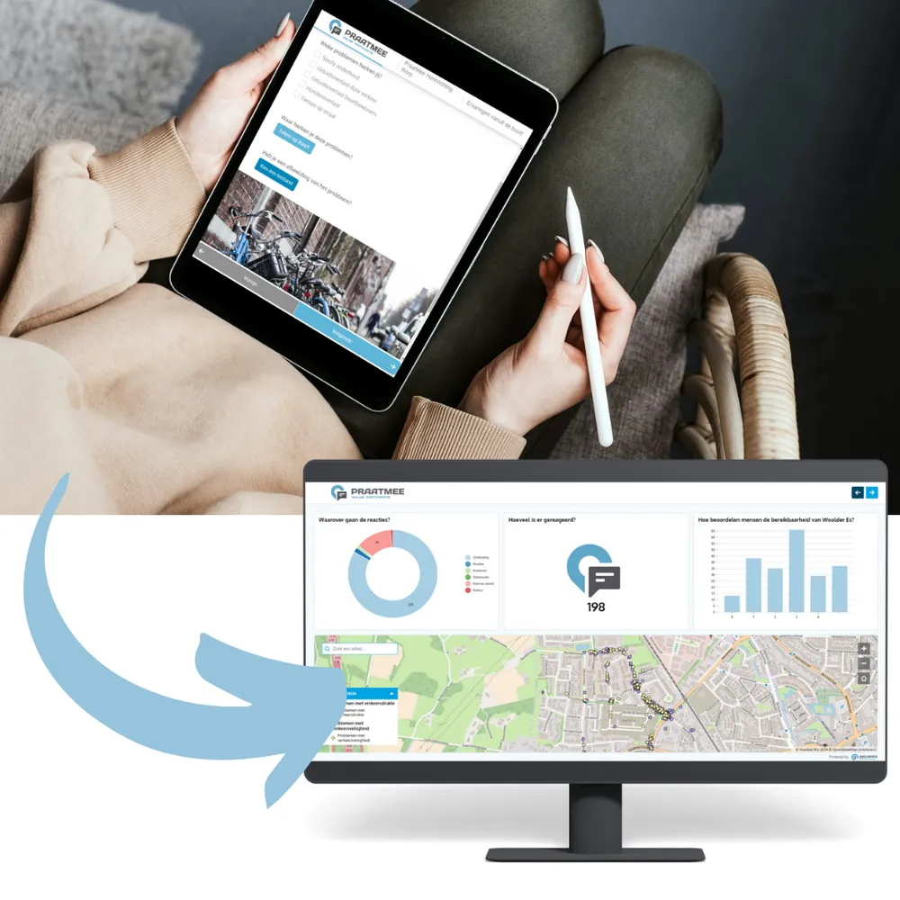
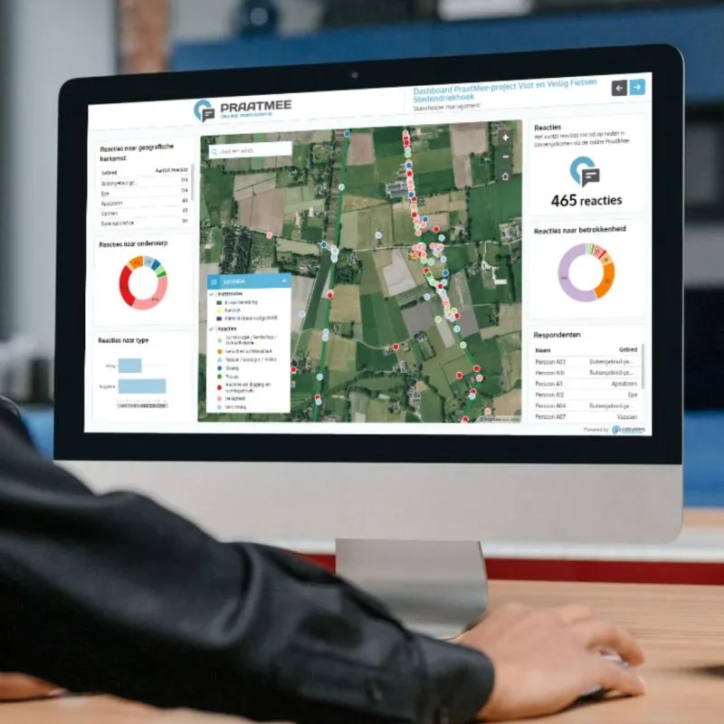
Analyze results
View all responses as a map or dashboard and use the insights for better decision-making.
Interactive dashboards and map visualizations
Trend analysis and sentiment detection
Export to CSV, Excel, or GIS formats
Customer stories
Discover how organizations use MapTalk to make participation easier, smarter, and more effective.

Gemeente Deventer
"By using PraatMee, we have received more responses from citizens. Especially from the younger target group, the input was remarkably high. It is a very pleasant medium, especially in these times."
Judith Meekes, Project Manager
Ready to transform citizen participation?
Join the organizations that already use MapTalk to better involve residents and stakeholders in their plans and decisions.


MapTalk FAQ
Frequently asked questions about the MapTalk citizen participation platform.