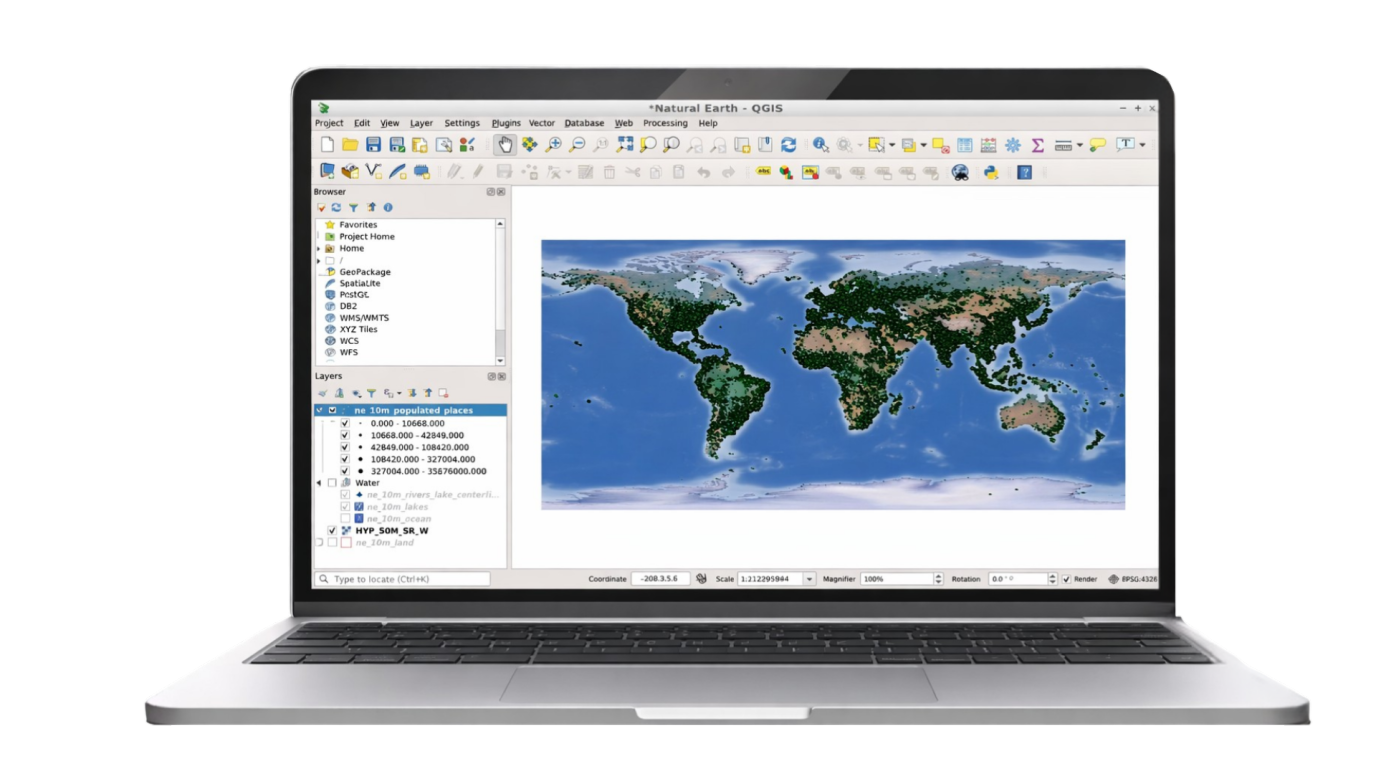
GeoApps plugin for QGIS
Publish your QGIS projects directly online without export or conversion. The GeoApps plugin for QGIS seamlessly connects your desktop GIS workflow to the web, so you can easily share maps and data with your team and stakeholders. Transform your QGIS projects into professional web maps with one click.
Trusted by organizations worldwide
GeoApps is used by leading organizations for their spatial challenges.


Why QGIS & GeoApps?
QGIS excels at desktop GIS: analysis, styling, and data preparation. GeoApps excels at putting maps and data on the web for your team and stakeholders. Together they cover the full workflow.

Use QGIS for what it does best: powerful analysis, cartography, and data prep.
Use GeoApps for sharing, collaboration, and web and mobile access without extra export work.
The plugin connects both so you publish from QGIS to the web in a few clicks.

GeoApps is a QGIS Sustaining Member
We're a Sustaining Member because we believe in the tool you use every day. Our plugin connects your QGIS workflow to the web, so you get the best of both worlds.
We give back to the ecosystem
As a Sustaining Member we support the QGIS project financially. That helps the project keep growing and improving, for everyone who relies on open-source GIS.
Your workflow, connected
Prepare and style data in QGIS the way you always do. The GeoApps plugin lets you publish to the web in a few clicks, with no conversion headaches or manual export runs.
Desktop and web together
Use QGIS for the heavy lifting; use GeoApps for sharing, collaboration, and polished web maps. One workflow, two platforms that work together.
GeoApps and the GeoApps plugin are GeoApps products. As a QGIS Sustaining Member, we support the QGIS project, but we are not part of the QGIS project itself. The plugin seamlessly connects to QGIS for users who want to use both.
Why the QGIS plugin?
Discover all the benefits of seamless integration between QGIS and GeoApps.
One-click publish
Publish your QGIS project or layers to GeoApps with minimal setup. No manual conversion or export runs.
Styles and symbology
Your QGIS styling can be reused when creating a map layer, and your GeoApps styling remains intact during updates so data is synchronized but web maps match your desktop maps.
Secure and scalable
Data is published to your GeoApps environment with your existing access control and branding.
Always in sync
Update in QGIS and republish when ready; your web maps stay up to date.
Fast workflow
Save time by publishing directly from QGIS without intermediate steps. Your workflow stays efficient and streamlined.
Global access
Make your maps immediately available on the web for your team and stakeholders, anywhere in the world.
Better collaboration
Easily share maps and data with colleagues and partners. Collaborate on projects without complex export processes.
Save time
No more manual conversions needed. Publish directly and focus on what matters: your geodata and analyses.
How it works
From QGIS to the web in four steps.
Prepare in QGIS
Create or open your project, style layers, and prepare data as you always do in QGIS.
Install and connect
Install the GeoApps plugin, connect to your GeoApps environment, and sign in if required.
Publish
Select layers or project and publish to GeoApps. The plugin handles upload and configuration.
Share and collaborate
Use GeoApps to share maps and apps with your team and stakeholders; update by republishing when needed.
Discover how the QGIS plugin works for you
Request a demo or contact us to discuss how you can seamlessly connect QGIS with GeoApps.


Frequently Asked Questions about the QGIS Plugin
Answers to frequently asked questions about the GeoApps QGIS Plugin.