Reliable insights for future-proof policy decisions
Interactive sustainability platform for mapping environmental impact, energy transition, and climate adaptation. Support your sustainability goals with data-driven insights.
Trusted by organizations who work on sustainability
Organizations using sustainability map for their environmental and energy transition projects


Sustainability Solutions
Discover how Sustainability Map can support your sustainability initiatives
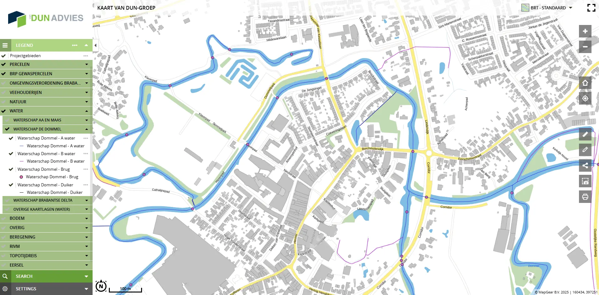
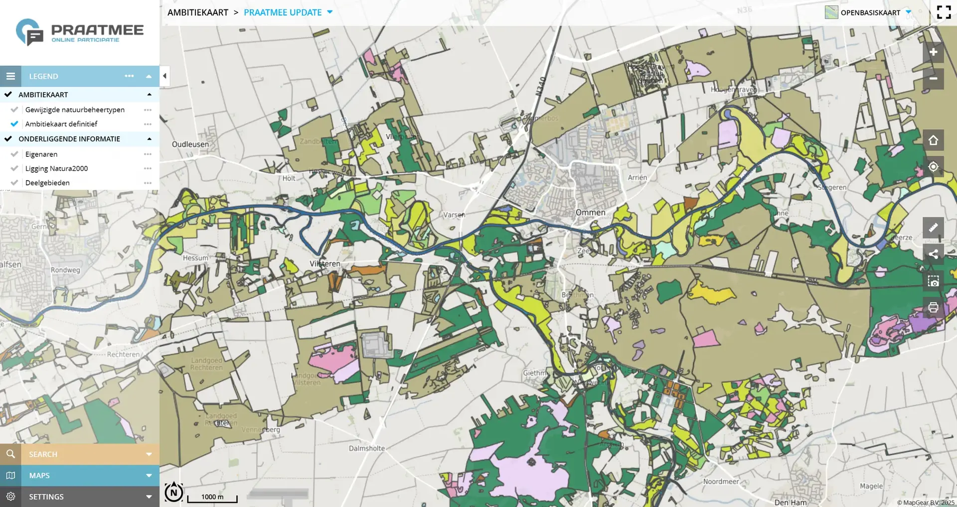
Interactive Sustainability Maps
Create responsive maps that engage users with smooth interactions for sustainability data
Energy Transition Support
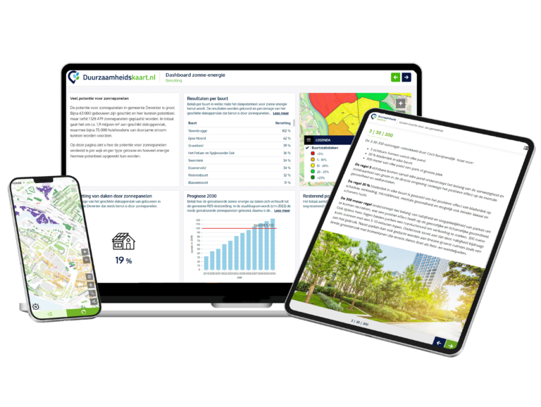
Support the energy transition with solar potential analysis and renewable energy mapping
Stakeholder Engagement
Engage stakeholders with interactive tools and collaborative sustainability planning
Environmental Impact Analysis
Analyze environmental impact and biodiversity for better decision-making
Climate Adaptation
Model climate change effects and develop effective adaptation strategies
Sustainability Monitoring
Monitor sustainability goals and performance with real-time data and reporting
Specific Sustainability Applications
Practical solutions for different sustainability challenges
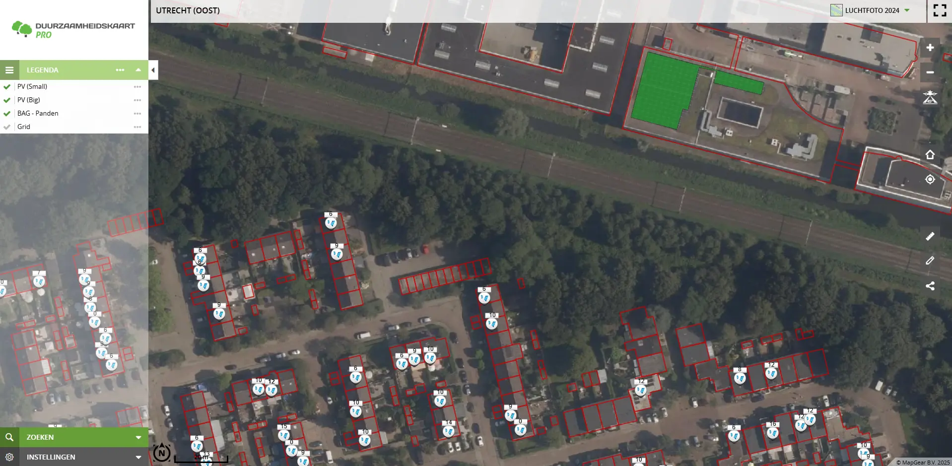
Solar Map & Energy Transition
Analyze the solar potential of all roofs and support the energy transition with accurate, current data.
Climate Adaptation & Water
Map the risks of flooding, drought and heat stress and develop adaptation strategies.
Environmental Monitoring & Biodiversity
Monitor environmental impact and biodiversity with advanced GIS tools and real-time data.
What Our Clients Say
Hear from organizations using our sustainability platform

Waternet
"Calculations that used to take us a week are now done in minutes. This saves us enormous amounts of time and money."
Harry de Brauw, Energy Transition Advisor
Ready to start your sustainability journey?
Join hundreds of organizations using our platform for their environmental and energy transition projects


Frequently Asked Questions about ESG-Mapping
Answers to frequently asked questions about ESG-Mapping, products, approach and implementation.