GeoApps Logo
Apps
Solutions
Platform
About us
Get adviceLogin
Hero background
  1. Home
  2. Solutions
  3. GIS/GEO Consultancy

Unlock more value from geodata across your organization

Bring maps, analyses, geo-information, and BI together in one powerful platform. Especially for GIS specialists and geo-teams who want to set up, further develop, and seamlessly integrate map-oriented applications within their organization. GeoApps supports connections with internal and external data sources, combines geo-data with BI dashboards, and uses current data, powerful visualizations, and open standards. This way, you can translate complex data into usable insights and decisions faster.

Who uses GeoApps for GIS & Geospatial Solutions?

Discover how GeoApps helps organizations optimize their operations
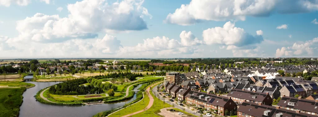
Municipalities

Municipalities

Municipalities

Comprehensive GIS infrastructure and data management for municipal operations.

GeoApps
Environmental Services

Environmental Services

Environmental Services

Advanced GIS tools for environmental monitoring and regulatory compliance.

GeoApps
Engineering & Consulting Firms

Engineering & Consulting Firms

Engineering & Consulting Firms

Professional GIS solutions for spatial analysis and project management.

GeoApps
Softwareentwickler

Softwareentwickler

Softwareentwickler

GIS-Plattform-Integration und maßgeschneiderte Anwendungsentwicklung.

GeoApps

Trusted by leading GIS organizations

  • FactoGeo
  • Gemeente Rotterdam
  • Arcadis
  • Provincie Overijssel
  • MapServices
  • Gemeente Utrecht
  • Stantec
  • Keypoint
  • Gemeente Enschede
  • Provincie Utrecht
  • Wegenscanners
  • Arup
  • Gemeente Hengelo
  • Mapification
  • Kragten
  • Gemeente Apeldoorn
  • Provincie Gelderland
  • Satellic
  • Tauw
  • Gemeente Maastricht
  • Procap
  • Gemeente Ede
  • Provincie Noord-Holland
  • Roelofs
  • MapGear
  • Gemeente Epe
  • Roelofs Lemelerveld
  • Gemeente Gennep
  • Provincie Flevoland
  • Dekker Groep
  • Gemeente Maasgouw
  • Thius
  • Gemeente Wierden
  • Provincie Groningen
  • Tijdlab
  • PraatMee
  • Gemeente Zundert
  • Mateboer
  • Gemeente Haarlemmermeer
  • Provincie Drenthe
  • Aveco de Bondt
  • Gemeente Groningen
  • Riese & Geurts
  • Gemeente Deventer
  • OMWB
  • Gemeente Dordrecht
  • TTE
  • Gemeente Rijswijk
  • KWR
  • Gemeente Leiden
  • Lycens
  • Gemeente Sittard-Geleen
  • Nordend
  • Westerkwartier
  • Slagboom & Peeters
  • Royal HaskoningDHV

Why choose GeoApps?

Trusted GIS/GEO partner in Europe

GeoApps is developed in the Netherlands, meaning you can always get development & consulting support from a European provider, and use the software in your preferred language.

Modern, flexible approach

Easily get rid of your legacy GIS-providers with a modern stack of editable web-map-apps available within 1 clear license, open standards and extensive integration possibilities with your existing workflows and systems like QGIS or an ERP.

GIS/GEO experts

A comprehensive platform developed by and in collaboration with experts in GIS and geo-information.

Data integration and management

Bring all your geo-information together in one place and work with a single reliable picture.

  • One central environment for all your geo-data
  • Current information through automatic connections and updates
  • Secure exchange of data via APIs and standards
  • Converting and combining data into usable maps and insights
  • Better data quality through control and validation
  • Always insight into performance and availability
Data integration and management

Analysis and visualization

Support for digitization of maps and geo-information, application development, and spatial data management.

  • Smart models for advanced spatial analyses
  • Predictive analyses based on trends and developments
  • Recognizing patterns and connections in large amounts of data
  • Automatically signaling and mapping objects and changes
  • Support for decision-making with AI-driven insights and scenarios
Analysis and visualization

Sharing and collaboration

Work seamlessly on desktop, mobile and TouchTable with the same maps and insights.

  • Interactive presentations and map exploration on a large format
  • Multi-touch operation for groups and sessions
  • 3D visualization and interactive scenarios
  • Collaborating remotely with the same maps and data
Sharing and collaboration

Choose the right GIS strategy and architecture

Ensure that your geo-information is used in a future-proof manner. With a clear strategy and robust architecture, you get more out of data, systems, and processes.

  • A clear GIS strategy and customized step-by-step plan
  • Designing a scalable enterprise architecture
  • Clear agreements on data quality and ownership
  • Connections between GIS and your existing systems
  • Improving performance and availability
  • Security and compliance with laws and regulations
Choose the right GIS strategy and architecture

What does GeoApps deliver?

Better data integration

Advanced analyses

Better collaboration

Work more efficiently

"For both simple map publications and more complex functions, such as user management and advanced analyses, GeoApps offers us the flexibility and possibilities we need."
Christiaan Jolly, Product Manager, Stantec
MapGear

GIS Partner Spotlight: MapGear

MapGear is our parent company and specialist in GIS consulting & development. We support organizations in building GIS departments, developing custom applications, and optimizing workflows around the GeoApps platform, QGIS, and other GIS technologies.

Discover what's possible
GIS Partner Spotlight: MapGear

Please accept cookies to play this video

Related Apps

Discover our apps that perfectly complement this solution

Viewer

Viewer

Interactive map viewer for spatial data

Dashboard

Dashboard

Data visualization and analysis dashboard

Custom

Custom

Custom GIS solutions for your needs

Fieldwork

Fieldwork

Mobile app for field data collection

Take the next step with GeoApps

Organizations that deal smartly with maps and data work faster, save costs, and make better decisions. With GeoApps, you lay the foundation today to seize opportunities and be ready for tomorrow.

Contact Us
GeoApps Viewer
Gasfabriek project
MapGear team office

GIS/GEO Implementation & Consulting - Frequently Asked Questions

Answers about data, collaboration and implementation for GIS and geodata workflows.

Which data sources can we connect?
Connect PDOK, BAG, BGT, Kadaster and your own PostGIS/ArcGIS endpoints. Import plans, drawings and scenarios; publish selected layers securely.
How does GeoApps integrate with existing GIS software?
GeoApps works seamlessly with desktop GIS software like QGIS and ArcGIS. Data is exchanged effortlessly without conversion effort, allowing you to continue working with your trusted tools while benefiting from web-based collaboration.
Can we work in 3D?
Yes. Use 3D models for sightlines, volumetry and scenario comparisons. Share web viewers for quick validation. GeoApps integrates with 3D engines that support BIM files.
What does onboarding include?
Setup, data ingest, roles/permissions, training and handover. Typical onboarding is 2–4 weeks depending on scope. Sometimes we run a pilot project for a quarter with organizations switching from old GIS stacks or using WebGIS for the first time.
Do you support custom development?
Yes. We offer integrations and features on retainer or project basis with roadmap alignment and SLAs. This includes specialized tools, custom applications, and workflow optimizations tailored to your organization.
How does pricing work?
We price via subscriptions, plus an onboarding fee and optional development fees if needed. We aim for flexibility. For details, see our subscriptions page.
GeoApps Logo

GeoApps is the leading software platform for GIS applications and spatial data, enabling organizations to make data-driven decisions.

Solutions

  • Urban Planning
  • Infrastructure
  • Real Estate
  • Environment & Climate
  • Energy Transition
  • Safety & Risk

Products

  • GeoApps
  • Solutions
  • Sustainability Map
  • MapServices
  • TouchTable
  • Consultation

Apps

  • Viewer
  • Dashboard
  • Fieldwork
  • MapTour
  • MapTalk
  • Custom

For whom?

  • Municipalities
  • Provinces
  • Environmental Services
  • Engineering
  • Contractors
  • Safety Regions

Platform

  • Integrations
  • Documentation
  • System Status
  • Changelog
  • Support
  • Subscriptions

Company

  • About Us
  • Careers
  • Contact
  • Partners
  • News & Blog
  • Events

Stay up-to-date

Subscribe to our newsletter to get the latest updates on our products and services. You can unsubscribe at any time.

Keep an eye on our socials too

Stay connected with us through our social media channels and get the latest updates on our products and services.

Quality & trust

MapGear is ISO 9001 and ISO 27001 certified and meets the highest quality and security standards for our products and services.

ISO 9001 Certificering
ISO 27001 Certificering
QGIS Membership 2026

© 2026 GeoApps, a product of MapGear B.V.

Privacy PolicyTerms of Service