GIS platforms in the Netherlands: a practical guide to choosing the right solution
GIS is being adopted by more organisations across sectors, but the landscape of GIS platforms and mapping software can be confusing, especially for international readers who may not recognise Dutch-specific providers.
In this article, we explain what we mean by a GIS platform, outline key distinctions like Desktop versus Web GIS, and help you understand how to choose the right platform for your needs. We do not attempt to list all vendors or features, instead, we focus on decision criteria you can use for your organisation.
What do we mean by a GIS platform?
A GIS platform is a solution that helps organisations collect, manage, visualise and share spatial data and insights. It may include tools for mapping, analysis, dashboards and collaboration that support decision-making across teams.
This goes beyond a simple map viewer. A GIS platform enables your organisation to:
organise spatial information centrally
share interactive maps and dashboards with stakeholders
integrate spatial insights into workflows and decisions
This type of platform is becoming increasingly important as spatial challenges grow more complex and more roles within an organisation need access to up-to-date geographic information.
Desktop GIS vs Web GIS: what’s the difference?
When organisations begin evaluating GIS technology, they often mix up Desktop GIS and Web GIS, even though they serve different purposes.
Desktop GIS refers to software installed locally, mainly used by GIS specialists for data preparation and advanced spatial analysis. It provides deep analytical capabilities and detailed editing functions.
In contrast, Web GIS is designed to make spatial information widely accessible through web browsers. It enables sharing maps and dashboards with broader audiences, including decision-makers, project leaders, and external stakeholders.
Many organisations use both: Desktop GIS for preparing and analysing data, and Web GIS for publishing, collaboration and organisational use. A modern GIS platform supports this combination rather than forcing a choice between them.
How to choose the right GIS platform
There is no single “best” GIS platform for every organisation. The right choice depends on your goals, workflows, users and context.
Here are key factors to help guide your decision:
1. Define your objectives and users
Who will use the platform? Is it primarily GIS experts, or does your organisation need broad access for project teams, managers and partners?
Understanding your audience helps clarify requirements for ease of use, access levels and training needs.
2. Determine your workflows
Different workflows require different capabilities. For example:
data preparation and analysis
organisational dashboards
publishing and storytelling
collaboration across teams
Mapping these workflows helps you prioritise features.
3. Understand how Desktop and Web GIS interact
If your organisation relies on deep spatial analysis, Desktop GIS tools like QGIS play an important role. Web GIS complements this by making results accessible to non-specialists. Clarifying how these two types of tools will work together avoids duplication and confusion.
4. Consider governance and data management
Who will manage and update datasets? How will data quality be maintained?
Good governance ensures consistent and reliable spatial data across departments.
5. Assess technical and organisational constraints
Evaluate factors such as:
hosting and data storage options
integration with existing systems
security and compliance requirements
scalability and future needs
This helps align the platform with both technical and organisational realities.
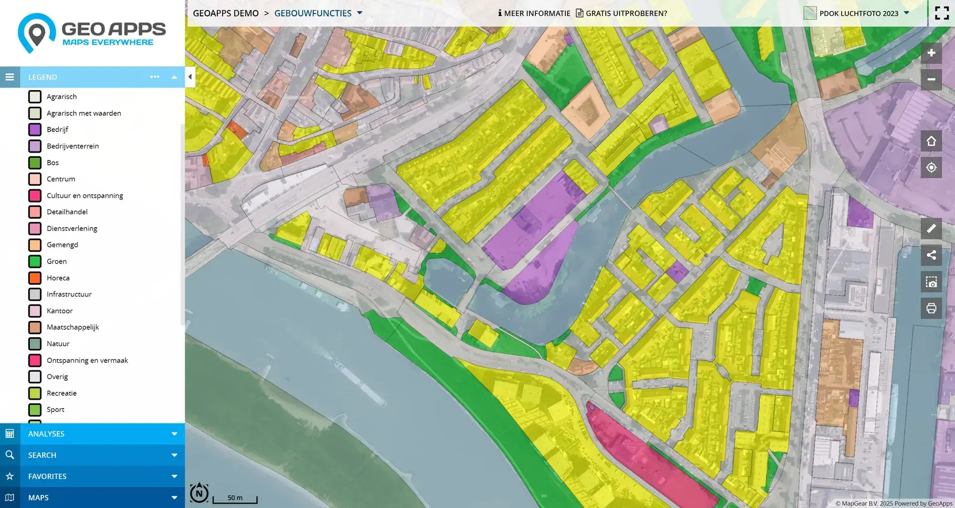
Where GeoApps fits in
GeoApps is a Web GIS platform designed to make spatial data and insights accessible across an organisation. It complements Desktop GIS tools by providing a space where analysis results can be shared through interactive maps and dashboards.
Instead of replacing tools like QGIS, GeoApps focuses on making spatial information understandable and useful for a wider audience, including decision-makers and stakeholders who do not work with traditional GIS software.
This makes it suitable for organisations that need to integrate spatial data into workflows, decisions and communication processes.
Need help choosing a GIS platform?
Choosing the right GIS platform is not just a technical decision — it also involves workflows, users, governance and organisational fit.
If you’d like to:
explore which type of GIS platform aligns with your goals
understand how Desktop GIS and Web GIS can work together in your context
get a strategy or roadmap for implementation
👉 Schedule a consultative strategy session In this session, we help you think through your situation and outline potential directions for a future-ready GIS approach, without obligation.